


Voting District 002, Benton County, Arkansas
About
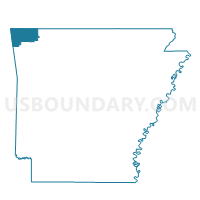
Outline

Summary
| Unique Area Identifier | 525994 |
| Name | Voting District 002 |
| County | Benton County |
| State | Arkansas |
| Area (square miles) | 30.45 |
| Land Area (square miles) | 30.44 |
| Water Area (square miles) | 0.01 |
| % of Land Area | 99.96 |
| % of Water Area | 0.04 |
| Latitude of the Internal Point | 36.46109760 |
| Longtitude of the Internal Point | -94.45998010 |
Maps


Graphs
Select a template below for downloading or customizing gragh for Voting District 002, Benton County, Arkansas


Neighbors
Neighoring Voting District (by Name) Neighboring Voting District on the Map
- Voting District 001, Benton County, AR
- Voting District 003, Benton County, AR
- Voting District 024, Benton County, AR
- Elkriver East Voting District, McDonald County, MO
- Elkriver West Voting District, McDonald County, MO
- Pineville South Voting District, McDonald County, MO
Top 10 Neighboring County Subdivision (by Population) Neighboring County Subdivision on the Map
- Township 10, Benton County, AR (16,402)
- Township 11, Benton County, AR (12,273)
- Elk River West township, McDonald County, MO (1,982)
- Elk River East township, McDonald County, MO (1,413)
- Pineville South township, McDonald County, MO (1,191)
Top 10 Neighboring Place (by Population) Neighboring Place on the Map
Top 10 Neighboring Unified School District (by Population) Neighboring Unified School District on the Map
Top 10 Neighboring State Legislative District Lower Chamber (by Population) Neighboring State Legislative District Lower Chamber on the Map
- State House District 98, AR (40,678)
- State House District 100, AR (36,953)
- State House District 131, MO (36,451)
Top 10 Neighboring State Legislative District Upper Chamber (by Population) Neighboring State Legislative District Upper Chamber on the Map
Top 10 Neighboring 111th Congressional District (by Population) Neighboring 111th Congressional District on the Map
Top 10 Neighboring Census Tract (by Population) Neighboring Census Tract on the Map
- Census Tract 209.02, Benton County, AR (6,443)
- Census Tract 703, McDonald County, MO (5,890)
- Census Tract 210.01, Benton County, AR (5,167)
- Census Tract 208.01, Benton County, AR (3,982)